Platform Products Aurora™ askAurora™ Aurora:GeoStudio® Capabilities Use Cases Governance C3.ai Request Access

Use Case · Aerial ISR & Defense

Fusing aerial ISR with geospatial intelligence.

Aerial ISR sees the shape and movement of a vehicle or crowd — but not identity, origin, or digital footprint. Aurora™ fuses live aerial sensing with historical geospatial intelligence to close that loop, under lawful, governed, human-supervised use.

Sector: Defense & Aerial ISR Partner: Unmanned-systems ISR provider Classification: Unclassified / Illustrative
The Challenge

Aerial ISR sees the what, not the who.

Legacy aerial ISR shows what is moving — shapes, vehicles, crowd density — but resolving who is moving, where they came from, and how they connect digitally has historically required a massive ground-based intelligence apparatus. Passive observation alone leaves identity, origin, and network footprint unresolved.

The Approach

A continental-scale geospatial engine.

Aurora's geospatial engine ingests billions of daily geolocation data points — location analytics, IP and base-station structure, application monitoring, and mobile advertising identifiers — into the Aurora:GeoStudio® data lake. That historical depth is what an aerial feed can be fused against to add identity and origin context to a live track.
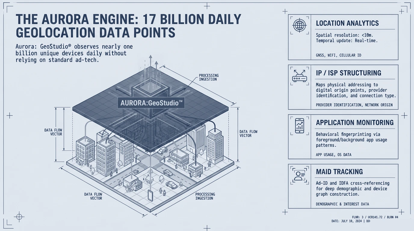
The Aurora engine ingesting billions of daily geolocation data points from multiple source types into the Aurora:GeoStudio data lake.
The Aurora engine. Billions of daily geolocation data points — analytics, network structure, application signals — fused into a single historical geospatial foundation.

From raw pings to a governed, filtered picture.

A three-stage intelligence-filtration pipeline turns raw signal into resolved insight. GeoCapture™ — the net — collects all device presence in an area of interest. GeoCanvass® — the filter — applies precise time and space parameters to isolate critical anomalies from the noise. GeoRunDown® — pattern of life — builds the localized identity profile and resolves predictive, recurring behaviors.
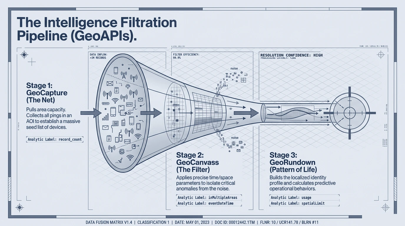
A three-stage filtration funnel: GeoCapture collects all pings, GeoCanvass filters by time and space, and GeoRunDown builds a pattern-of-life profile.
The intelligence filtration pipeline. Capture the area, filter to the critical anomalies, and resolve a localized pattern of life — high-confidence, low-latency, governed.
The Outcome

Closed-loop pattern of life, aligned to the aerial feed.

As the aerial platform loiters over an area of interest, Aurora cross-references its live footprint against historical geolocation context in real time. High revisit scores flag residential anchors, workplaces, and persistent networks; high new-visit scores flag transit hubs and anomalous single-time presence — an active pattern-of-life picture generated alongside the live aerial view, under human oversight.
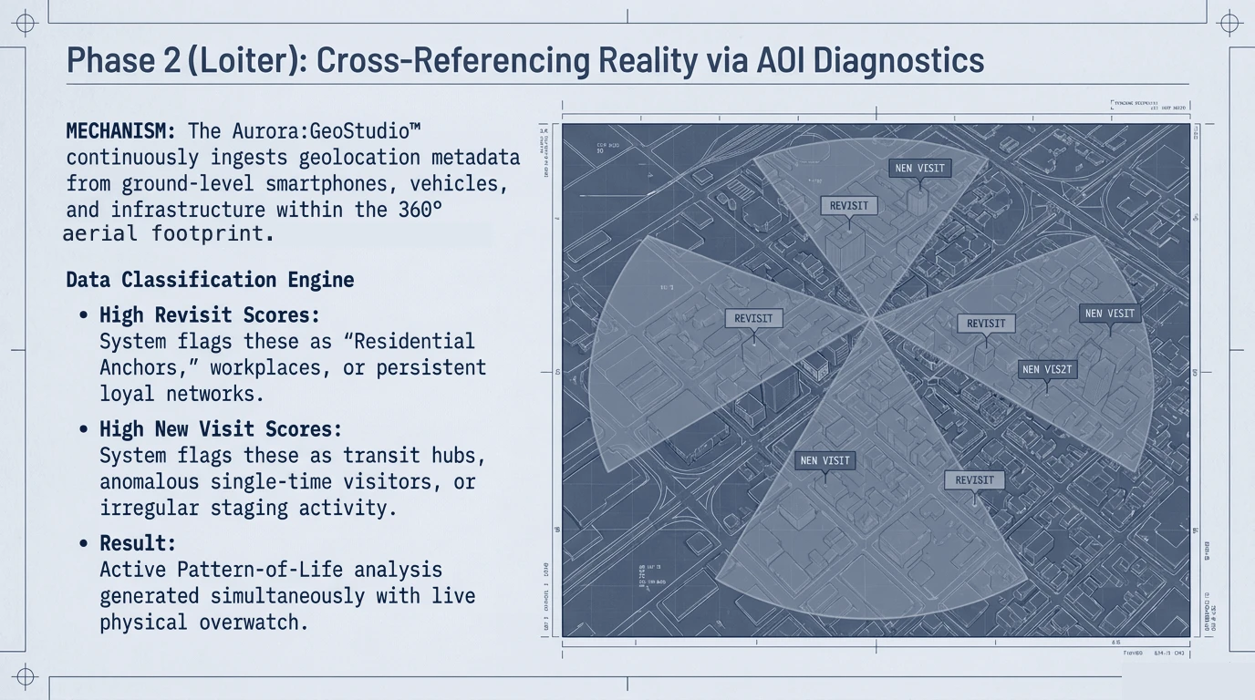
A radial diagnostic over a city grid classifying areas of interest by revisit and new-visit scores within the aerial footprint.
Cross-referencing reality. Within the aerial footprint, a data-classification engine separates residential anchors and persistent networks from transit hubs and anomalous presence.
Identity
Who, not just what, behind a live track
Origin
Likely bed-down and recurring locations resolved
Governed
Lawful, authorized use with human oversight
Note on sourcing. This case study is drawn from a partner engagement with an unmanned-systems ISR provider, presented at a releasable level. Partner and platform identities, locations, and operational specifics have been removed or generalized, and the material reflects lawful, authorized, human-supervised use; figures are illustrative of the analytical method. Reproduced visuals have had identifying names redacted.

Close the loop between sensing and knowing.

Aurora™ is available to authorized defense and government organizations, under governed and lawful use. Access begins with a defined mission problem.