Use Case · Maritime Domain Awareness
A vessel can disable its transponder, but the people, devices, and physical mass behind it cannot all go dark at once. Aurora™ fuses digital geospatial intelligence with a persistent physical-sensing layer to resolve threats that cross inland, coastline, surface, and subsurface domains.
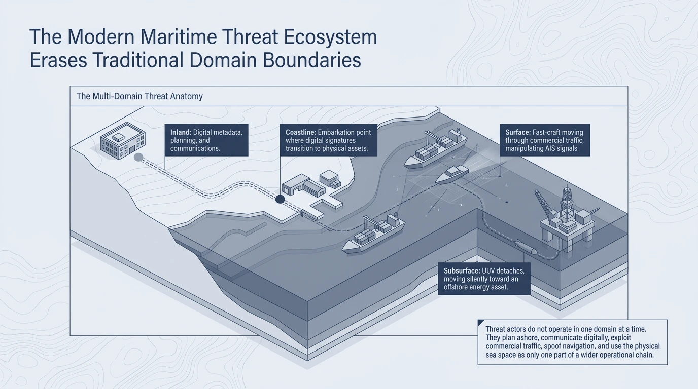
Threat actors do not operate in one domain at a time. They plan ashore, communicate digitally, manipulate AIS signals while moving through commercial traffic, and exploit the subsurface to approach offshore energy assets. The physical sea space is only one part of a wider operational chain — and legacy maritime awareness, built on vessel surface tracks alone, sees only a fraction of it.
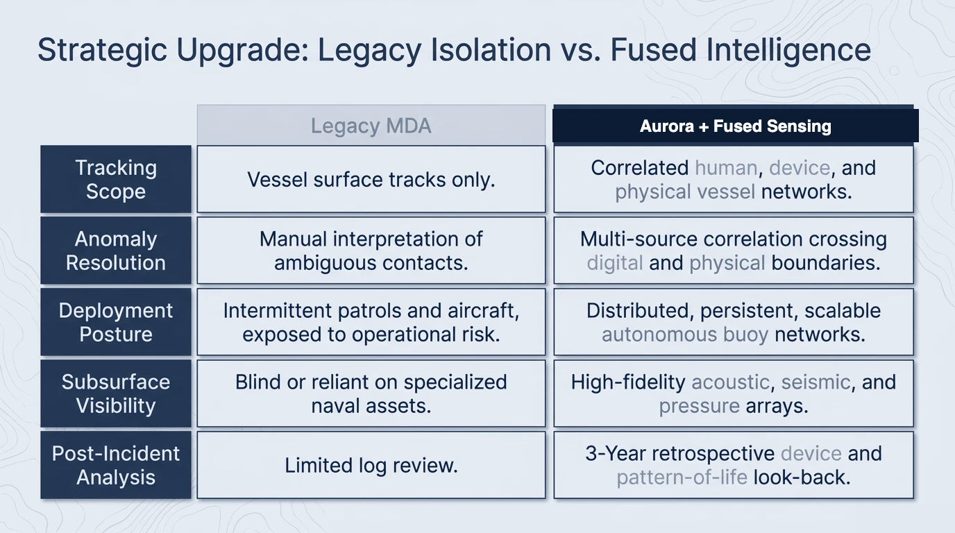
Aurora replaces single-domain isolation with multi-source correlation that crosses digital and physical boundaries. Where legacy maritime domain awareness offers vessel surface tracks and manual interpretation of ambiguous contacts, the fused architecture resolves human, device, and physical-vessel networks together — backed by distributed, persistent sensing and a multi-year pattern-of-life look-back.
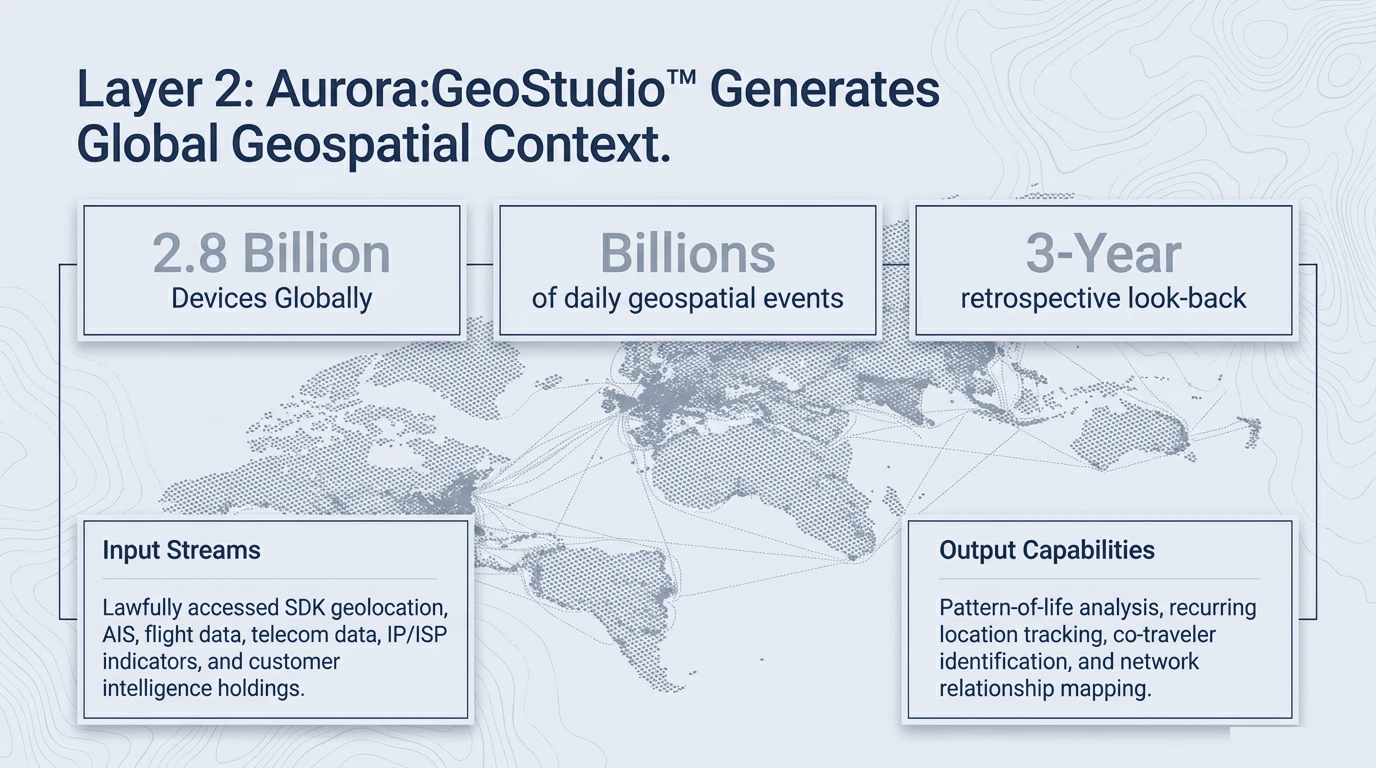
Aurora:GeoStudio® generates the digital context layer — ingesting lawfully accessed device geolocation, AIS, flight data, and telecom indicators into a single environment, with a three-year retrospective look-back for pattern-of-life analysis, recurring-location tracking, co-traveller identification, and network-relationship mapping.
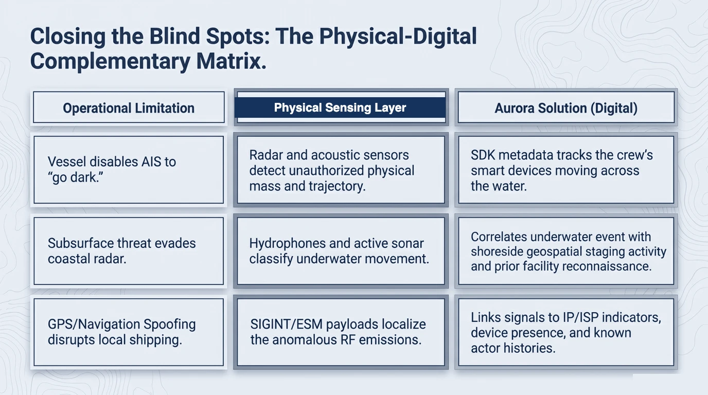
Each operational limitation that defeats single-domain tools is answered twice — once in the physical domain and once in the digital. When a vessel disables AIS to go dark, physical sensing detects unauthorized mass and trajectory while device metadata tracks the crew's movement across the water. When navigation is spoofed, SIGINT/ESM localizes the emissions while Aurora links the signals to IP/ISP indicators and known actor histories.
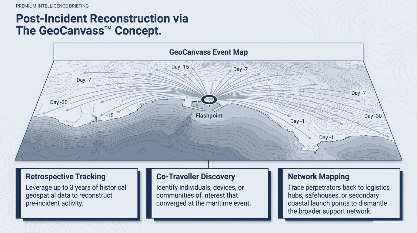
After an incident, Aurora:GeoCanvass® reconstructs up to three years of pre-incident activity around a flashpoint — identifying co-travellers and communities of interest that converged at the maritime event, and tracing perpetrators back to logistics hubs, safehouses, and secondary coastal launch points to dismantle the broader support network.
Aurora™ is available to authorized government and partner organizations. Access begins with a defined mission problem.